DIGGING INTO NEWCASTLE: Tracing the Tunnels That Shaped a City
Long before coal was discovered, these ridges and creeks formed part of the traditional homelands of Coast Salish–speaking peoples, including the Duwamish and Snoqualmie. Their trails, fishing sites, and seasonal camps shaped the landscape for generations. That Indigenous presence continues today through enterprises such as Snoqualmie Casino & Hotel, Eighth Generation, and the Salish Lodge & Spa, ventures that carry forward traditions of ingenuity, hospitality, and connection to the land.
In 1863, surveyors Philip H. Lewis and Edwin Richardson noted coal along a creek soon known as Coal Creek. By 1869, F. H. Whitworth proposed renaming the area “New Castle,” a nod to the English coal city and the idiom “carrying coals to Newcastle.”
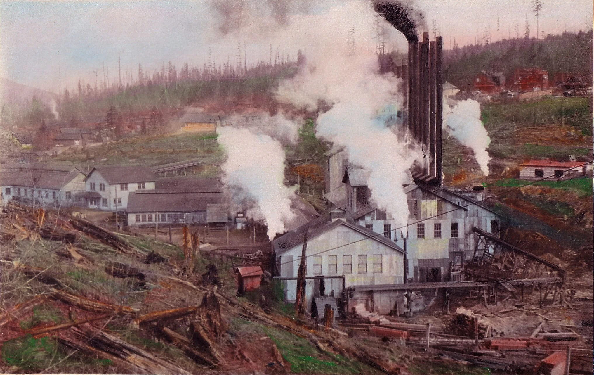
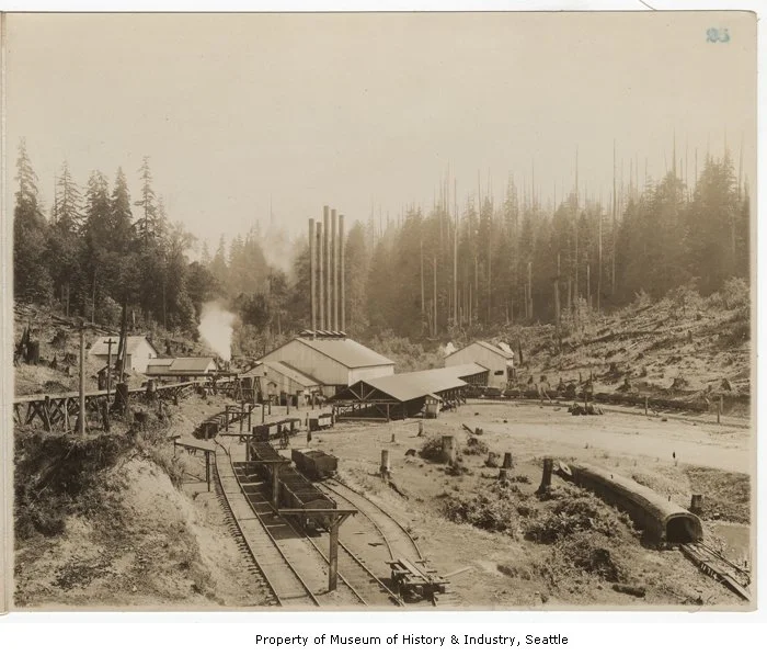
Through the 1920s, Newcastle’s rich seams fueled Seattle’s transformation from a timber town to a modern city. Coal from these hills lit lamps, powered ships, and warmed homes. Though the shafts have long been sealed, the land still remembers.
The first large-scale mine opened in 1863 when prospectors from the Lake Washington Coal Company struck a rich vein. Over the next fifty years, more than ten mining companies operated across the Coal Creek Valley. Shafts dropped hundreds of feet underground while horizontal drifts snaked in all directions in search of the best seams.
Geologists later mapped the Newcastle Coal Seam as part of the greater Cedar–Issaquah Coal Field, a belt of carbon-rich rock running from Renton to Issaquah. What now appears as rolling terrain once dictated every practical decision: where the railroad ran, where workers built their homes, and where miners dared to dig.
Modern Newcastle sits directly atop this layered history. Subdivisions like Newcastle Highlands, Olympus, and China Creek were built over once-active tunnels. Before construction, engineers surveyed each parcel to locate shafts and collapse zones; some were filled, others sealed and left intact.
If a lawn subtly sags or a patch of ground drains oddly after rain, it may echo that buried past. Digitized King County mine maps still reveal honeycombed passages beneath the hills.
For generations, children growing up in southeast King County traded stories about hidden mine entrances deep in the woods. Some were real, later sealed by city crews or the Forest Service, while others existed only in imagination.
By the 1980s, as new homes spread into the area’s once-forested hills, city engineers began a safety program to locate and cap unstable shafts, filling them with concrete and regrading the land above. Similar discoveries occurred nearby: in 1963, during construction of the I-405 S-curves in Renton, crews uncovered an old mine entrance now entombed beneath the freeway.
Smaller family-run operations such as the New Lake Youngs Mine on Renton’s East Hill and several mines at the Caroline and Bear Creek Yards on the southwest flank of Tiger Mountain also left their mark. Between the 1920s and 1940s, these Tiger Mountain mines hummed with activity. Today hikers following the Fifteenmile Creek Trail can still spot weathered foundations and scattered timbers where shafts once opened to daylight.
A few relics endure elsewhere too. In Cougar Mountain Regional Wildland Park, remnants of early mining shacks and refuse piles have yielded century-old bottles and pottery, traces of a time when the hills rang with picks and pulleys.
Today, Newcastle’s valleys and ridges appear tranquil, home to trails, parks, and neighborhoods, yet the ground beneath remains restless, shaped by human hands and natural time. The sealed tunnels below stand as silent witnesses to how the Pacific Northwest’s growth once depended on what was drawn from the earth. To walk these paths is to trace both the scars and the healing of the land. Beneath Newcastle’s forested slopes, the same hills once darkened by coal dust now shimmer with ferns and filtered light. What was mined and scarred has become a place of renewal—a living record of endurance, memory, and transformation.
To experience this history firsthand, start at the Coal Creek Natural Area in Newcastle, the most accessible place to explore the region’s mining heritage.
Getting There:
From downtown Newcastle, head south on Coal Creek Parkway SE for about two miles, then turn right onto SE 79th Place. Continue a short distance to the Red Town Trailhead parking area at the intersection with Lakemont Boulevard SE. Trail maps and restrooms are available at the site.
What You’ll See:
From the trailhead, follow the well-marked path into the forest. Within minutes you’ll pass fenced openings where cool air still exhales from sealed mine shafts. Iron rails half-swallowed by roots and rusted cartwheels lie in quiet surrender to moss and ferns, a living reminder that what once roared with industry now breathes only the forest’s rhythm.
Interpretive signs describe the history of Newcastle’s mines and the tunnels that still run unseen beneath nearby neighborhoods. The trail winds along Coal Creek, through alder and cedar stands, where nature slowly reclaims the land shaped by a century of human effort.
For Further Learning:
Newcastle Historical Society: newcastlewahistory.org
Coal Creek Natural Area Trails Map (King County Parks): kingcounty.gov/parks/trails/coal-creek-natural-area
Crows of Arroyos: Adventures in Serendipity – locating lost coal mines of King County: batgurrl.net
Washington Geological Survey: Abandoned Coal Mines in Washington (PDF)